
P17 · I.06(b) · Tools · Industrial · Low carbon drilling
Low carbon drilling — multi-lateral geothermal pathways
Deep multi-lateral designs (Li · H₂ · CO₂ · closed-loop / Eavor-class) and the industrial transfer of drilling know-how to low-carbon heat — with EGS, France potential maps, and a clear priority on low-risk surface geothermal.
GEO-MULTI-LATERAL-SPECS-LI-H2-CO2-EAVOR-FD-2026 · Rev 3G · François Dorléans · EngEthics
Partner review (protected): each section has a #tag. Comments blocked for public until Login.
Contents
- 1. Purpose & documents
- 2. Architectures (multi-lateral · closed-loop)
- 3. EGS — Enhanced Geothermal Systems
- 4. Public perception & industrialisation gap
- 5. France — basins & official sources
- 6. Competition with oil & gas ROI
- 7. What is useful immediately
- 8. Surface geothermal priority (<200 m)
- Map · geothermal capacity (artistic)
- References & downloads
2. Multi-lateral architectures (including “lobster antenna” layouts)
3. EGS — Enhanced Geothermal Systems
4. Under our feet — perception vs industrial reality
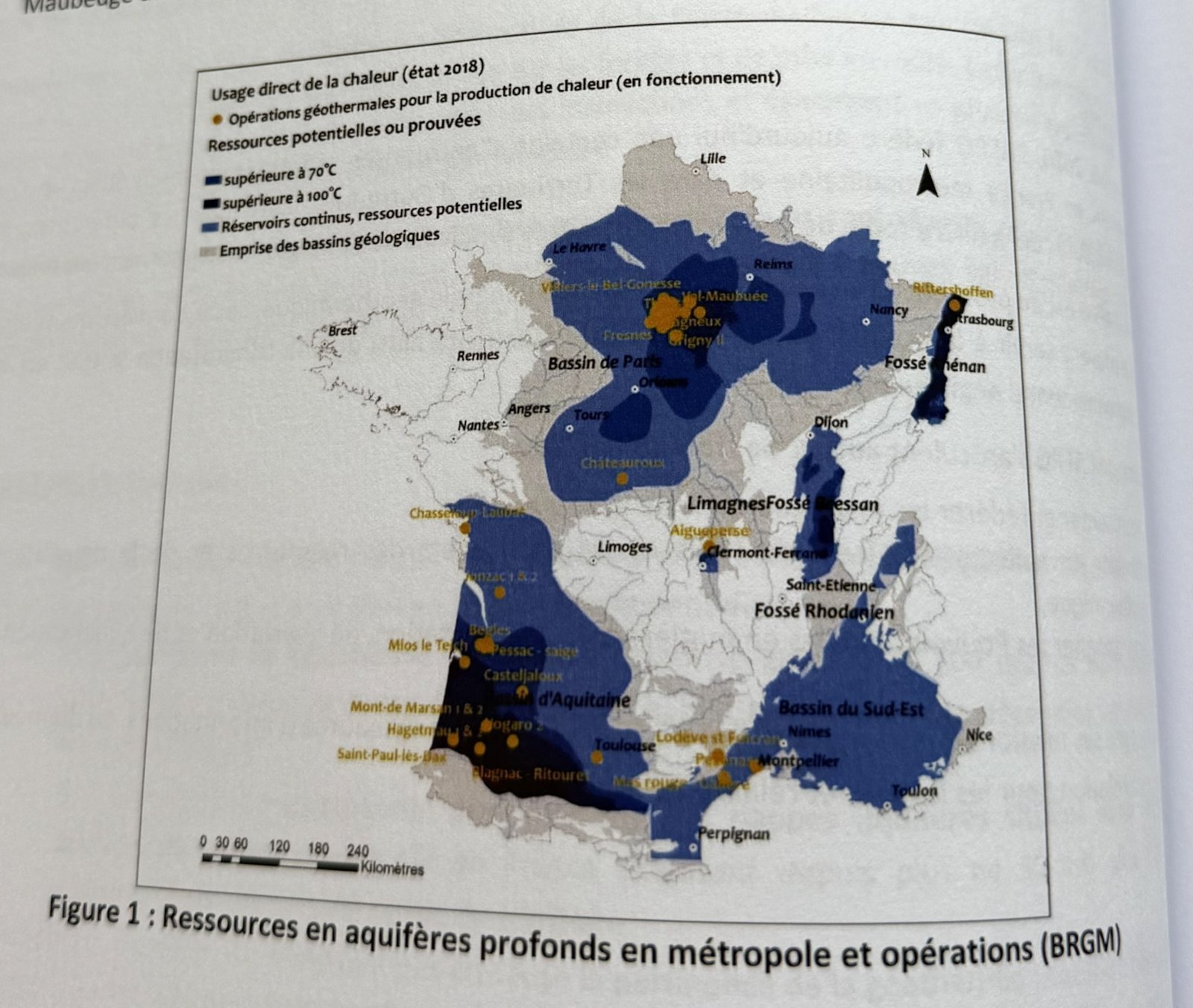
5. France — basins, heat operations & official maps
6. Deep geothermal vs oil & gas — shared tools, unequal ROI
7. What is useful and feasible immediately
8. Priority path — intense surface geothermal (< ~200 m)
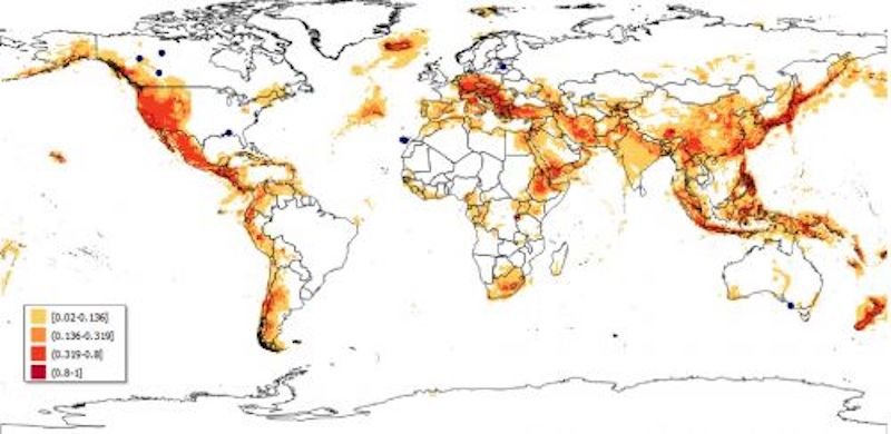
Geothermal suitability — indicative global map
References & downloads
PDF Rev 3G DOCX Rev 3G PDF Rev 2G DFKPS I.06(a) SOA